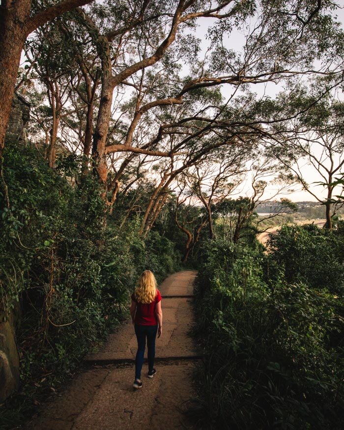
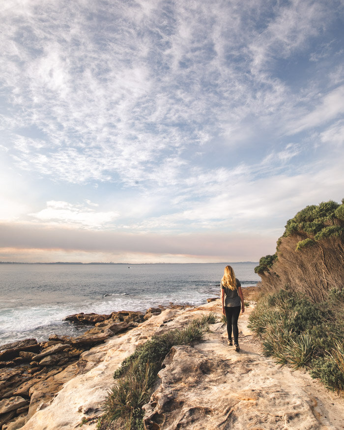
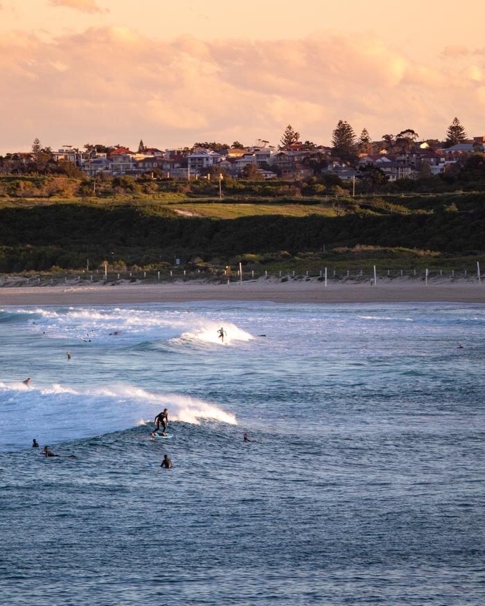
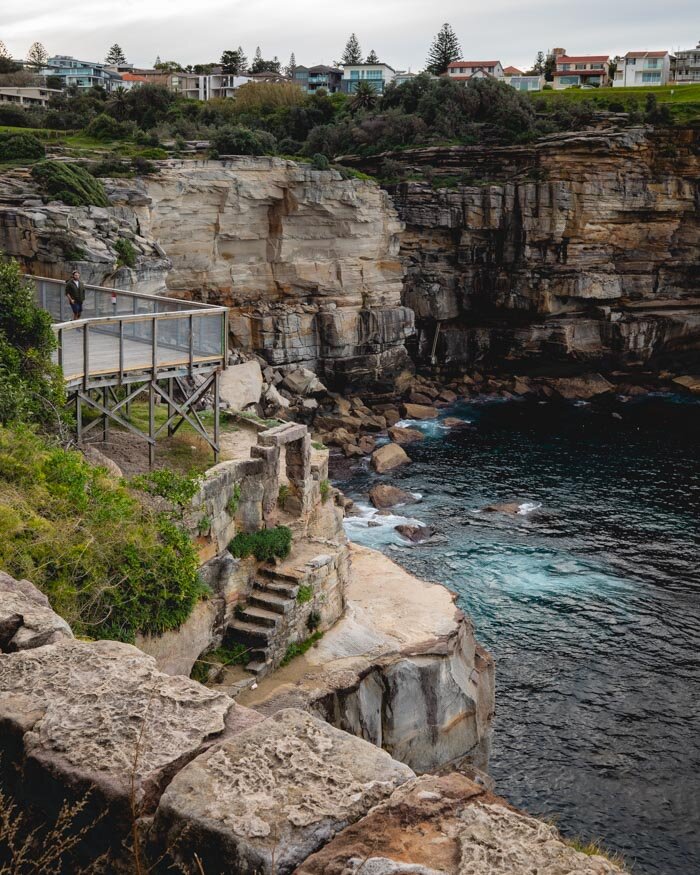
You’re spoilt for choice when it comes to choosing a Sydney coastal walk. Whether you’re looking for something close to the city, or something a bit more remote in one of the nearby national parks, Sydney has you covered.
The coastal tracks are good at any time of year, in the warmer months they provide a bit of breeze and the chance to cool off in the ocean or in a rock pool, and in the cooler months many of them have an excellent chance of spotting Humpback whales.
We’ve walked dozens of trails and have put together a list of our favourites, ranging from easy strolls to longer half day hikes. These walks all stick to the coast, here are some ideas for harbour and bush walks.
Here are our favourite coastal walks in Sydney.
It comes as no surprise that many of the best coast walks in Sydney are in Royal National Park. This incredible park has many hiking trails that combine to form a 26km epic called (surprise, surprise) the Coast Track! However, you can do individual sections of this trail as short day hikes.
The trails on our list that aren’t in Royal National Park are very close to the city, making them some of the most easily accessible walks in Sydney.
-
1. Wattamolla to Eagle Rock - Royal National Park
2. Cape Baily Lighthouse - Botany Bay
3. Palm Beach Lighthouse
4. Cronulla Beach Walk
5. Malabar Headland Walk
6. Jibbon Beach Loop - Royal National Park
7. Botany Bay Coastal Walk
8. Wattamolla to Little Marley Beach - Royal National Park
9. Bondi to Coogee
10. Bundeena to Wedding Cake Rock - Royal National Park
11. Coogee to Maroubra
12. Cape Banks Circuit - La Perouse
13. Garie Beach to South Era - Royal National Park
14. Federation Cliff Walk
15. Dee Why to Manly
15 Stunning Coastal Walks in Sydney
1. Wattamolla to Eagle Rock, Royal National Park
Distance: 8.8km
Elevation: 235m
Difficulty: Easy
Type of trail: Return
Accessible by public transport: No, but you can use the park shuttle
We hate it when we’re asked to choose a favourite when there are so many amazing trails, but if you were to twist our arms we’d tell you it’s this one. The Wattamolla to Eagle Rock walk is special from beginning to end.
There are no mediocre bits, it really is a mind blowing walk full of beautiful views, with a grand finale featuring a double drop waterfall that cascades into the ocean and Royal National Park’s most iconic rock formation.
The track does have a small amount of climbing, but it’s never very steep and almost the whole thing is board-walked so it makes it a really leisurely walk.
Allow plenty of time for photos on this track because the opportunities are truly endless!
We’ve got all the details on the trail, including our personal favourite way to do it (for sunset) in this post.
2. Cape Baily Lighthouse, Botany Bay National Park
Distance: 6.9km from Cape Solander or 9.3km from Polo Street
Elevation: 72m
Difficulty: Easy
Type of trail: Return
Accessible by public transport: Yes
This is one of the best - if not the best - whale watching walk in Sydney. It has provided us with the closest encounters that we’ve had with whales, that weren’t on a tour boat.
In fact, if you go in the peak season (mid June to early July) you may find yourself distracted to the point that it’s hard to complete the walk, as you spot whale after whale.
That’s what happened to us which is the reason the photos get darker and darker throughout the trail!
Even if you’re not visiting in whale season, this walk is a delight, with panoramic ocean views, rugged cliffs, hanging swamps and a picturesque lighthouse at the end.
The trail has been upgraded in recent years, gone are the bogs of the past which really put a dampener on things and instead the metal boardwalk provides the perfect surface for a very easy stroll.
Here’s our full trail guide for more details.
3. Palm Beach Lighthouse
Distance: 2.5km total from The Boathouse cafe
Elevation: 96m
Difficulty: Easy (but steep)
Type of trail: Partial circuit
Accessible by public transport: Yes
It might be short, but this trail wows with views from beginning to end. The trail also happens to start from one of our favourite cafes which is never a bad thing ;)
It might be steep, but the terrain on this walk is really good, so it’s not difficult, and you can stop for as many ‘photo breaks’ as you need!
You get wonderful views back to Palm Beach and Station Beach, which provides a really lovely photo opportunity.
From the lighthouse at the top you can see in the other direction out to Ku-ring-gai National Park and the Central Coast.
When all the little white sailboats are out on a sunny day it has definite Whitsundays vibes!
If you’re a fan of hidden spots you might also be interested in the picturesque Barrenjoey Cave which requires a short bush bash to reach.
You’d never find it if you didn’t know it was there, so we’ve included how to get there in this post.
4. Cronulla Beach Walk
Distance: 7.3km
Elevation: 104m
Difficulty: Easy
Type of trail: Circuit
Accessible by public transport: Yes
Lots of people know about the promenade that runs from the main beach at Cronulla, but less people know you can actually continue on and make this track into a circuit.
It’s a lovely, easy and relaxing stroll which has fabulous views almost the entire way, including some great opportunities to get up close to surfers and snap some good pics.
The first half of the trail is paved and as well as glorious ocean views, also passes lots of rock pools where you can stop for a dip.
Our favourite section is actually the latter part of the circuit though, when crowds seem to melt away and you’re left with the whole path to yourself.
You’ll pass lots of gorgeous greenery as well as our favourite sunset beach in Sydney - it’s so relaxed that it reminds us of little coves in Port Stephens.
Here are all the details, including how to make it a circuit, as there are no signposts to direct you.
5. Malabar Headland Walk
Distance: 6.4km
Elevation: 102m
Difficulty: Easy
Type of trail: Circuit
Accessible by public transport: Yes
The Malabar Headland Walk is a great option when you don’t want to stray too far from the city, but you want to avoid the crowds on the more popular trails, like Bondi to Coogee.
The walk starts and ends at one of our favourite beaches in Sydney, Maroubra, and will take you first through a little bit of pretty bushland, before curving back round to the coast.
The ocean views are incredible and if you’re lucky enough to be walking during whale season you will hopefully be in for a treat. We saw so many from this track, particularly around Boora Point.
Walking along the cliff top you can see the city ahead of you in the distance and it’s one of those moments when you really appreciate just how incredible it is that you can see the city, bushland and whales all from one spot.
It’s an easy trail with very little in the way of uphill sections. Its one downside is poor sign posting along one part of the circuit, but we’ve got you covered with directions in this post.
6. Jibbon Beach Loop, Royal National Park
Distance: 5.3km
Elevation: 76m
Difficulty: Easy
Type of trail: Circuit
Accessible by public transport: Yes
The Jibbon Beach Loop Track is an absolutely stunning and easy trail, which visits one of Royal National Park’s best beaches, some well preserved Aboriginal engravings and hugs the cliff tops for much of the way, offering incredible ocean views.
Unlike the majority of beaches in the park Jibbon Beach has calm turquoise water which is perfect for swimming - the track loops back to the beach at the end so you can easily have a refreshing post walk dip.
For the most part, the trail is flat and in great condition so you can really relax and make the most of the views.
You could walk the trail in a little over an hour, or spend the whole day enjoying Jibbon Beach and stopping for lunch in one of the cafes in Bundeena (where this walk begins).
Here’s our full Jibbon Beach Loop guide.
7. Botany Bay Coastal Walk
Distance: 11.8km
Elevation: 100m
Difficulty: Easy
Type of trail: One way
Accessible by public transport: Yes
This walk works best with a car shuffle or by using public transport, because otherwise you are going to be walking for over 20km! It’s almost entirely flat, so that’s not out of the question, but one way is preferable!
This walk begins along the same route as the Cape Baily Lighthouse Track, taking in the gorgeous ocean views along the cliff tops until you reach the lighthouse.
The trail then continues all the way to Cronulla Beach, passing lots of little rock pools and small shelly beaches, never leaving the ocean.
You’ll also pass Boat Harbour Beach, which is the only beach in Sydney you can legally drive on! Don’t worry though because it’s very wide and they only drive on a short portion.
If you’re someone who loves long strolls on the sand, this is the track for you, because the final 4.4km are all along the beach. The sand is compact so it’s also easy to walk on and incredibly relaxing!
We’ve got more track details in this guide.
8. Wattamolla to Little Marley Beach, Royal National Park
Distance: 7km
Elevation: 177m
Difficulty: Easy
Type of trail: Return
Accessible by public transport: No, but you can use the park shuttle
This walk is one of our favourites in Sydney and is a beautiful track from start to finish.
Most of the path is metal boardwalk, which makes it a really breezy trail, allowing you to take full advantage of your surrounds, rather than having to look down at your feet!
You’ll visit Wattamolla Dam, which is a great wild swimming hole - particularly if you’re not a huge fan of wavy ocean swimming - before passing through pretty heathland which is always brimming with birdlife.
You’ll then walk along the cliff tops with incredible ocean views, before descending to the spectacular Little Marley Beach, one of our favourite secluded beaches in Sydney.
It’s not the best for swimming as there can be rips and we often see Bluebottle jellyfish here, but you can take a dip in Wattamolla Dam, or at Wattamolla Beach on the way back.
You can also continue the walk further to Big Marley Beach which is what we usually do. We’ve got all the trail details in this guide.
9. Bondi to Coogee
Distance: 5.5km
Difficulty: Easy - moderate
Type of trail: One way
Accessible by public transport: Yes
This is easily the most famous coastal walk in Sydney. It might be popular, and feel crowded at points, but that is for good reason. It’s a glorious trail which takes you past some of Sydney’s prettiest beaches with amazing views almost every step of the way.
The whole trail is paved and whilst it isn’t flat, the good terrain means that it will be fairly easy for most people.
If you’ve got time on your hands, as well as stopping for a swim at one of the many beaches or ocean baths, you can also stop at Gordons Bay which is an incredible snorkelling spot.
It doesn’t matter which direction you walk it in, choose whichever best suits you transport-wise. Allowing a little time for a drink at Icebergs at the Bondi end or the Coogee Pavillon (which also has lots of games!) at the Coogee end is always a great way to finish.
You can read more in our Bondi to Coogee walk guide.
10. Bundeena to Wedding Cake Rock, Royal National Park
Distance: 5.7km
Elevation: 92m
Difficulty: Easy
Type of trail: Return
Accessible by public transport: Yes
Wedding Cake Rock is one of the most famous spots in Royal National Park and a quick look at Google images will tell you why. This brilliant white cliff edge makes for a pretty incredible photo opportunity.
However, over the last few years a crack has developed and the rock could tumble into the ocean at any minute.
And that’s why there is now a ginormous fence surrounding it.
Whilst that does kill the photo ops somewhat, this is still a fantastic walk. It’s almost entirely flat and takes you along the cliff tops for some truly fabulous ocean views. You are walking on natural rock for much of the way, and the swirly patterns are just beautiful.
Once you’ve had a chance to check out Wedding Cake Rock, which is definitely still worth seeing, you can extend the walk another kilometre along to the gorgeous Big Marley Beach, which is highly recommended if you have the time.
You can read our full guide to Wedding Cake Rock here.
11. Coogee to Maroubra
Distance: 4.9km
Elevation: 114m
Difficulty: Easy
Type of trail: One way
Accessible by public transport: Yes
The Coogee to Maroubra track is a great walk in its own right, or can be added onto to the Bondi to Coogee or Malabar Headland tracks for an extended hike.
The walk has fantastic ocean views for much of the way and passes many of Sydney’s most beautiful ocean baths, if you want to take a dip on route.
It’s also a quiet track despite being so close to the city, which is always a bonus in our eyes. It’s paved for the majority of the way making it the kind of walk you can blast through in an hour, or take your time, looking out for whales and dolphins and stopping for a swim along the way.
If possible, it’s best walked at low tide so you can minimise the time spent walking along the residential streets.
Check out our detailed trail guide for more information.
12. Cape Banks Circuit - La Perouse
Distance: 6.9km (9.2km inc all side trips)
Elevation: 223m
Difficulty: Easy
Type of trail: Circuit
Accessible by public transport: Yes
The Cape Banks Circuit is a great walk in the La Perouse area and visits a couple of fab beaches before winding its way around a wild and windswept headland, which is a great whale watching spot in season.
There aren’t too many coastal tracks which are circuits, so we really appreciate that you don’t have to go back on yourself, and get to see more of the area.
The views are gorgeous and though you are not always by the coast, the bits which are inland are through pretty bushland, which is definitely not a hardship.
There are a couple of worthwhile side trails which we detail in the post linked below, which is what makes it a slightly longer trail, for the circuit alone it’s just under 7km.
Here’s the full trail guide.
13. Garie Beach to South Era Beach, Royal National Park
Distance: 4.6km
Elevation: 197m
Difficulty: Easy - moderate
Type of trail: Return
Accessible by public transport: No, but you can use the park shuttle
This short, but sweet walk, visits three breathtaking beaches and virtually never leaves the ocean. It’s one of the most gorgeous walks in Royal National Park.
It’s quite a short walk, but has two fairly steep climbs. This makes it one of the harder walks on this list, but even so, it won’t phase most people and you can stop for as many photo breaks as you need on the hills!
The views from both sides of Thelma Head are absolutely fantastic and well worth the effort.
It’s also a great track for spotting wild wallabies which love the grass around the North Era campground, just behind the beach. It’s actually the only coastal track in the park we’ve seen wallabies on.
Both North and South Era beaches are generally very quiet so they make a lovely place to spend the day before heading back over the hill to Garie Beach.
Here’s our full trail guide for more details.
14. Federation Cliff Walk
Distance: 5km
Difficulty: Easy
Type of trail: One way
Accessible by public transport: Yes
We walked this trail as part of the longer Bondi to Watsons Bay trail, which we don’t recommend for reasons we outline in this post, so unfortunately we don’t have the elevation measurement for this specific section - but it’s not a hilly track by any means.
The Federation Cliff Walk begins at one of our favourite picnic spots in Sydney, Dudley Page Reserve, before heading along the cliffs at Eastern Reserve and Diamond Bay.
Looking at the huge waves crashing against the craggy cliff edges is really atmospheric and they are the kind of spots that you can find yourself lingering for a long while.
The next part of the walk takes you alongside the ocean towards Watsons Bay, taking in one of NSW’s oldest lighthouses.
As you near the end of the trail you’ll also get some fantastic lofty views of Sydney Harbour before you arrive at one of Sydney’s most spectacular lookouts, The Gap.
If you’d like a longer walk, rather than adding the portion from Bondi, we’d recommend adding the South Head Trail instead, which is a fabulous walk, taking you to two stunning beaches and another heritage lighthouse.
15. Dee Why to Manly
Distance: 6.4km
Elevation: 100m
Difficulty: Easy (or moderate via the low tide trail)
Type of trail: One way
Accessible by public transport: Yes
The Dee Why to Manly trail is one of our favourite walks in Manly. This track has it all: fantastic ocean views, four glorious beaches and the chance to visit the Manly Wormhole - a tunnel through the rock (which is very picturesque).
My favourite bit of the trail is between Dee Why and Curl Curl, where you walk along the cliff tops with great sea views, and if you’re lucky, some really pretty wildflowers and even a whale or two.
There’s the option to make the track a bit more adventurous. If you’re walking at low tide, you can head around the rocks from Freshwater to Queenscliff. If the tides are not in your favour, the high tide route is still great, and the whole walk is generally very easy going.
You could complete the track in under an hour and a half or make a day of it, stopping at various ocean baths and for a coffee or two along the way.
Here’s our full Dee Why to Manly trail guide.
This post may contain affiliate links, meaning at no additional cost to you, that we will earn a small commission if you click through and decide to make a purchase. This helps towards the costs of running our website. Thanks for your support.
Like it? Pin it!
Follow us on Social Media
What’s your favourite coastal walk in Sydney? Have you got any recommends for us? Let us know in the comments below!


