It had been a while since we had walked in the bush not to get somewhere, but simply for the joy of walking in the bush. And that’s exactly what this walk is, the chance to soak up the sights and sounds of some quintessential Aussie bushland.
While there are no major sights to see, it’s a very pretty section of the Great North Walk with some lovely water views and the greatest number of Yellow-tailed black cockatoos we have ever seen - or maybe we just got lucky!
The walk can easily be completed in just 1.5 hours and there are a few sections with via ferrata style metal rungs to keep things interesting. There’s even a campsite partway along if you wanted to make it a very easy overnighter.
Here’s what to expect on the track.

The Turners Fire Trail Circuit
The stats
Distance: 4.4km circuit
Elevation gain: 205m
Difficulty: Easy - moderate
Trailhead: Alston Drive, Berowra Heights
As the walk is a loop, it can be done in either direction. We opted for clockwise as we prefer a steeper ascent and shallower descent. We were happy with this decision as it meant we didn’t have to worry about footing on the steeper sections, however, if you prefer a gentler ascent you’ll want to go in the opposite direction.
Either way, there will be some hills to climb and descend and some of those steeper bits have metal rungs drilled into the rock to assist.
The circuit is not signposted, but we have included the directions below.
Starting the trail
From the parking area (full details below), to follow the trail in a clockwise direction you head straight into the bush on a narrow but well manicured path.
You’ll head gently uphill for 70m before the path flattens and then begins descending 130m later.


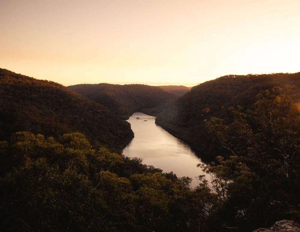
Roughly 155m into the descent you’ll see a social trail on the left. This leads to a beautiful view over Berowra Waters.
We were lucky enough to see the sea plane land as it made a drop off at the stunning Berowra Waters Inn.

It’s worth having a little wander along the rock platform to enjoy all the views before heading back onto the main track, this detour is just 45m each way.

You’ll continue along the bush track for another 350m before taking the left fork.
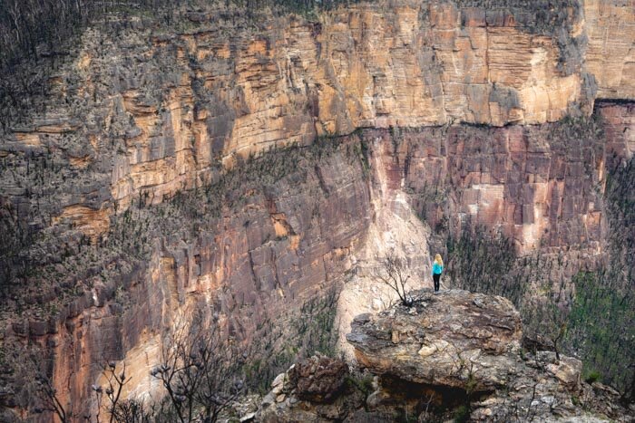
After another 500m in pretty bushland you’ll come to some more great views on the left. Again they are just moments off the main track.


Approximately 80m later, at the Great North Walk signpost, you follow the track to the right, heading down the rocky trail deeper into the bush.

The bush ‘via ferrata’
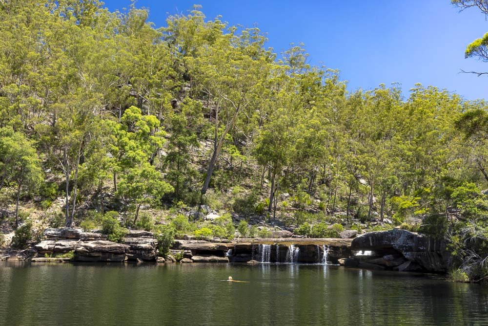
After 300m descending the path will briefly flatten before the descent continues. Just under 1.8km into the track you can make a 40m detour to the bottom of a small waterfall.
You will see a worn path on the left, it’s a touch overgrown, but easy to follow downhill to the base of the falls.


However, unless there has been plenty of recent rainfall it’s really just a dribble on a rock wall. Once back on the main track you’ll cross over the top of the falls and then begin heading uphill.
There is a series of picturesque overhangs and 70m later you’ll reach the first of the metal rungs.

The first couple of sets of rungs are quite short and very easy. They are really nicely spaced so it in no way feels precarious.
There is a bit of rocky track inbetween and then you will come to the third set of rungs which is the most substantial (around 2.2km into the walk).


There are a few more rungs here helping you up a longer, steeper section of rock wall. Again they are really well spaced, so there are no awkward moves required.
Just beyond the top of this climb you will come to the Roland Murray bench.

It sits sheltered in a small overhang and was the perfect resting point for us when the heavens suddenly opened. It was also the start of a staggering number of black cockatoo sightings.
There was something in the trees here they clearly loved eating and we enjoyed the raucous entertainment while we waited for the rain to subside.
Completing the circuit
From the bench you will come to the fourth set of rungs, which are again easy enough. The path continues to the left, just after the rungs - it looks like it might be a rocky scramble to the right at first glance.

You’ll then come to the fifth and final set of rungs before the path will flatten. Approximately 200m later you’ll make your way through a rocky gully and 50m beyond this there’s a nice viewpoint on your left.

Roughly 150m later you will reach a signpost and from here you stop following the Great North Walk and begin walking along the Turner Fire Trail.
The wide flat fire trail makes for easy walking and the black cockatoos continued to entertain us for the majority of the way.
Approximately 200m after you turned onto the fire trail you will come to a campsite on the right, this is the Ridge Top Campground.

It’s a small site with some picnic benches and a long drop toilet. If you’re short on time but want an escape into the bush, it would make for an ideal spot.
There are a couple of good views on the right side of the fire trail which you’ll see worn paths leading down to. Keep following signs for Turners Road which you’ll reach 850m after passing the campsite.

Roughly 250m later you’ll turn right onto Alston Street and follow it for 250m back to your car.
Parking for the Turners Fire Trail Circuit
The walk begins at the end of a residential street, Alston Road, beside the Berowra Park Conservation Reserve in Berowra Heights. You can see it here on Google maps.
It’s around a 45 minute drive from Sydney CBD.
This post may contain affiliate links, meaning at no additional cost to you, that we will earn a small commission if you click through and decide to make a purchase. This helps towards the costs of running our website. Thanks for your support.