

With white sand and calm clear water, Murrays Beach is the quintessential stunning beach you come to Jervis Bay hoping to find. It’s an idyllic place to swim, relax on the sand, or go for a little adventure. At low tide you can follow the shoreline round to find hidden coves, a small sea cave and some shallow rock pools.
You can also walk up onto the headland for some gorgeous views out to the ocean, which has fabulous whale watching opportunities in season (May to October).
Here’s everything you need to know about visiting Murrays Beach, including details on the walking track and how to find the sea cave.

Murrays Beach
From the nearest car park, the walk to Murrays Beach is along a well maintained bush track which is just 300m each way. There are a couple of stairs, but for the most part the walk is flat.
The beach itself is spectacular, though it does get very busy in high season. We love it most in the cooler months, when there’s barely anyone around, but the weather is still warm enough to relax on the sand and even go for a dip.

The Murrays Beach Cave
A note on tides
To reach the cave you want to visit close to low tide. We visited 2.5 hours before low tide, which is totally doable, however, it’s more comfortable to go even closer to low tide. That is primarily because the last section of the walk includes traversing a rock shelf which is covered in tiny shells that are pretty sharp!
If you have shoes that can get wet then it’s less of an issue, but barefoot it was a bit of a trial. You definitely want to avoid high tide when the water will come in and you’ll lose the rocks required to get round safely.

How to find the cave
Co-ordinates: -35.1250501, 150.7628969 - location on Google Maps
The cave is located 750m from the Murrays Beach car park, or 450m from the beach. From the point where you access the beach, head right (to the eastern end of the beach), all the way to the end of the beach (250m away).

From here you will begin heading along the rock shelves. There are a few rocks to climb over, but it’s generally easy and it would be even easier if you visit a little closer to low tide than we did (or you are wearing shoes that you can happily get wet).

You’ll reach a small cove after 50m (600m from the car park) and reach a second one 20m later. There are tiny spits of sand which are nice in that they are secluded, but rather small for lazing around on.


Roughly 30m from the second cove you will reach the rock platform with all the little shells, this is foot torture - you have been warned!

You’re now less than 100m from the cave. The last little bit to enter the cove where the cave is located requires walking through the water and over a couple of rocks. The water was around knee height for us 2.5 hours before low tide.
What to expect from the Murrays Beach cave
On first glance you could be forgiven for thinking that you can’t possibly be looking at the cave, it doesn’t look like a cave and it’s certainly not impressive. We weren’t sure we had arrived at the right spot until we had a closer look.

And on that note, this is not an impressive sea cave, this is a fun photo op. It’s interesting to see the view from inside the cave, but this is not going to be for you if you are expecting a huge overhang like the photos suggest.
The cave is tiny and full of rocks and trees. The view from inside is cool and best thought of as a view and not a cave.
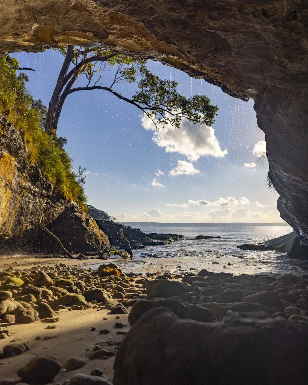
To get the best photos you’d ideally want a wide angle lens which we didn’t have, or you can use the 0.5 mode on your phone.
Now that there are logs inside the cave the angles are tighter than they used to be, but if you like photography you will probably still enjoy the spot. The logs also make a nice seat to watch the waves from!
If you’re visiting close to or a little after low tide, make sure you keep an eye on the time so that you can watch for the waves coming in and give yourself enough time to get back round to the beach without getting cut off.
The Munyunga Waraga Dhugan Trail (Murrays Beach Walk)
The stats
Distance: 5.9km loop
Elevation gain: 95m
Difficulty: Easy, but not flat
Trailhead: Murrays Beach Carpark, Booderee National Park
Summary: The Munyunga Waraga Dhugan Circuit walk is all on a well maintained path and though it has some climbs, it’s rarely steep. It’s worth noting that there is not much to see along one half of the circuit.
It’s a pleasant walk through the bush, but it won’t be for everyone, particularly if you have limited time in Jervis Bay. If that’s the case you might just want to do the first 1.1km to the Governor Head Lookout, which offers the best view of the whole walk.
If you want to do the full circuit, we’d recommend walking it anticlockwise so that the best views are at the end of the walk - no one likes to do the best bit first, right?

Starting the trail: into the bush
From the Murrays Beach car park the walk heads into the bush and reaches the junction between the circuit walk and the beach after 250m.
You can head left onto the beach now or save it for the end of the walk. The Munyunga Waraga Dhugan track heads right, to complete the trail anticlockwise you want to take the path on the far right.

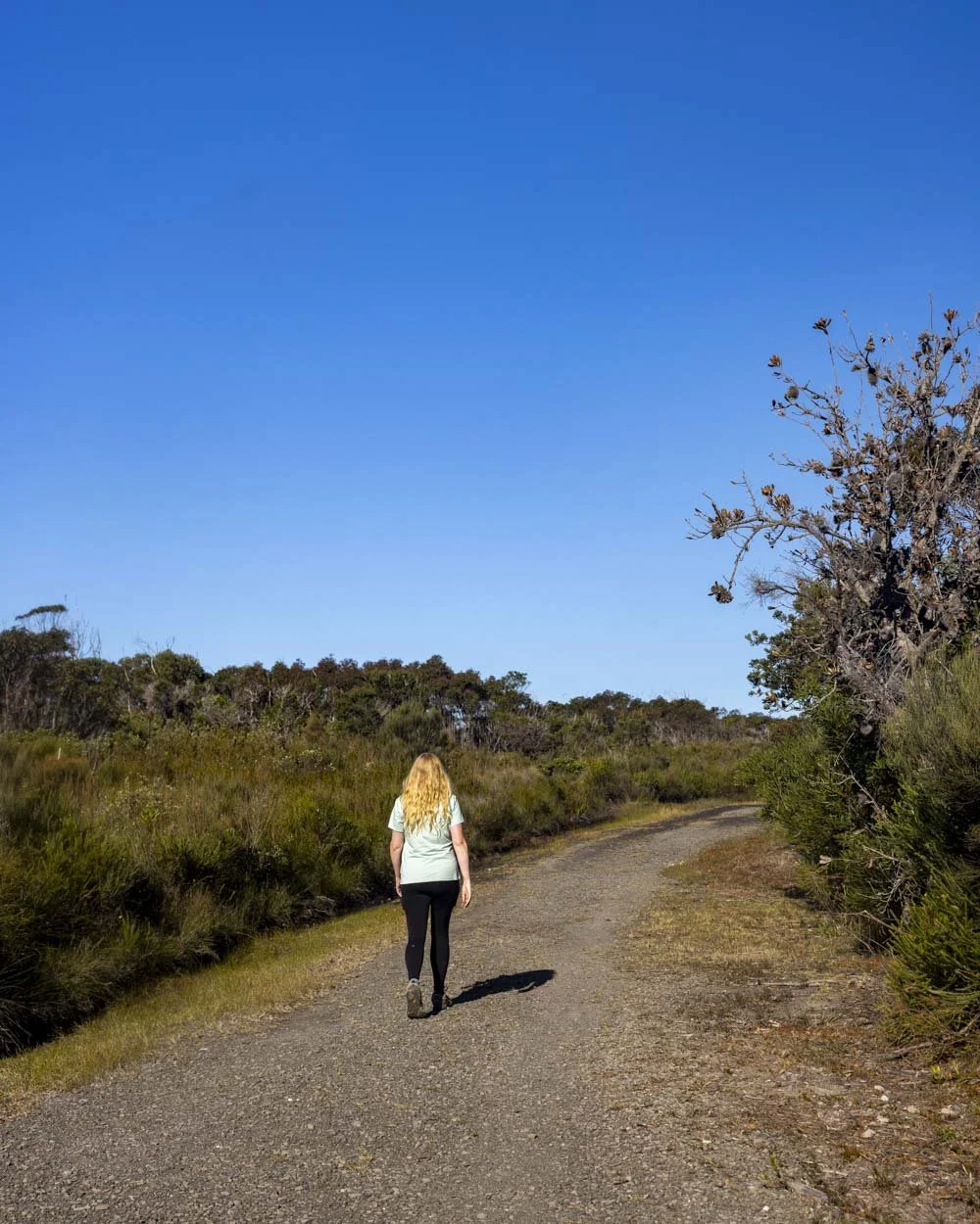
It’s a peaceful fire trail heading briefly and gently uphill before it all but flattens. It’s nice and bushy so there’s plenty of shade and an abundance of birdlife. Roughly 770m into the trail you’ll pass a small lake, but it’s very obscured from view.
There’s a signpost about the lake, but there’s not much to see. This first half of the walk really is more about stretching your legs in a quiet patch of bushland.


The trail continues in much the same vein until you hit the 2km mark and you’re now walking amongst low scrub.
The birdlife is even more prolific along this stretch, though you’re now fully exposed to the sun if you’re walking on a hot day.
Reaching the ocean views
The track will now head uphill, but it’s very gentle and doesn’t last long. You’ll arrive at a signposted junction 350m later and head left. As you’re walking anticlockwise none of the arrows point left.

You can see the ocean in the distance along most of this next stretch, however, there’s another kilometre to go before you get close up views which include the picturesque headlands.

At this point the track begins heading gently downhill. Roughly 350m later (3.8km into the walk) you’ll reach a view of the Devil’s Elbow.
This is a particularly striking headland, with a large sea cave at the base and some pretty wild waves.

You’ll get some more great views ahead as you continue descending, there is one slightly steeper bit of track as you make your way downhill, but nothing challenging.
We were walking after a lot of rain and the track held up really well, there was one small area of mud along this next stretch, but nothing that couldn’t be skirted around.
Arriving at Governor Head Lookout
At the 4.6km mark you’ll reach a signposted junction and head straight, following the short detour to Governor Head Lookout. The next 300m are downhill on a well maintained grassy path before you reach the railed lookout.

The view from here is dramatic with huge waves crashing against the rugged Bowen Island, home to 5000 pairs of Little Penguins.
As the penguins hunt by day and come in at night you’d sadly be hard pushed to spot one even if you did have a pair of binoculars with you!

Whales on the other hand are commonly spotted and we were lucky enough to see our first of the season, albeit at quite a distance.
Unfortunately you can no longer walk across to the next set of cliffs along which offer equally great views and were previously not fenced off.
We have fond memories of sitting and watching the waves from here, but sadly the whole area has now been railed, so you don’t have any unobstructed views anymore.

The view from Governor Head is still great, but it’s not the same as being able to sit and relax without a fence obscuring your view!
Completing the circuit
From the lookout you head back to the junction and then turn right, which takes you downhill on another bushy fire trail.

Roughly 100m into the fire trail you’ll get a stunning view of Murrays Beach and you can turn onto the worn social trail to get some nice pictures.
It’s from here that we noticed a path heading down to the small cove below. It’s steep, but we think it leads to the cave mentioned above, though we didn’t personally check it out.


Back on the main trail and you’ll continue downhill for 500m before reaching the junction with Murrays Beach. At this point you’re 50m from the beach or 250m from the car park.
Getting to Murrays Beach
The walk to Murrays Beach begins at the Murrays Beach car park in Booderee National Park. There is a small ford just before you reach the car park, but it was suitable for any car on our visit. However, if the water is high, you can park before the ford at the Murrays Beach Access Track parking area. This doesn’t add much distance onto the walk to the beach, though I think it adds a little uphill.
It’s around 20km and a 20 minute drive from Huskisson and 38km and a 35 minute drive from Nowra. It’s roughly 2 hours 45 minutes from Sydney CBD.
There are toilets at the car park and at the visitor centre, which you pass to reach the beach, as well as a couple of picnic benches behind the beach.
The Booderee National Park entry fee
Murrays beach falls into the fee zone for the Booderee National Park. Currently that fee is $20 for a vehicle to enter the park for one day.
There are concessions and annual passes available and as prices will no doubt change over time, you can see the current rates here.
This post may contain affiliate links, meaning at no additional cost to you, that we will earn a small commission if you click through and decide to make a purchase. This helps towards the costs of running our website. Thanks for your support.


