Located deep in a pristine cloud forest lies one of the most atmospheric waterfalls in all of Costa Rica. With towering mossy walls and turquoise water, this double drop waterfall has the wow factor. By the time we came to visit Catarata Vuelta del Cañon, we’d visited over 50 waterfalls in Costa Rica, and it still left us speechless. It’s the sort of place that feels like it could be in a fairytale.
It requires more effort than most to reach because you’ll have to make many river crossings. But in dry season the river is low and calm and the majority of the trail is flat.
Here’s everything you need to know about visiting Catarata Vuelta del Cañon.
The walk to Catarata Vuelta del Cañon
The stats
Distance: 10.2km return
Elevation gain: 250m
Difficulty: Moderate
Depending on recent rain the track will either be relatively easy, or a little more challenging. We hiked in the dry season (in March) but unfortunately for us there had been huge amounts of recent rain and the track was extremely muddy.
We’re talking tie your boots as tight as you possibly can or you’ll lose them type mud. And this was for around half the walk. Our friend had hiked the trail the year before in dry season and had virtually no mud whatsoever, so it’s really the luck of the draw.
Mud aside the terrain is generally quite easy, there are no steep ascents or descents, in fact it’s mainly flat. However, there are a number of river crossings.
For some you could rock hop if the water level is low enough, but you cannot rock hop all of them, so you will get wet no matter what.
However, the water level was usually knee deep or lower and never went above waist height (very rare) and this was after a lot of rain.
Before we get started - you’ll need to hire a guide
Before we get started on the trail notes, it’s worth knowing that you do need a guide for this walk. Even though there are a decent number of arrows along the path showing you the way, and you could probably manage fine without, it crosses private land, which is only allowed with a guide.
There are many different guides in the area, but it can be hard to lock one down! Before you even reach Bajos del Toro, you’ll see signposts advertising guides and there are more signs in town. There’s even a dedicated car park with more signs that include the number to call for a guide.
They never picked up, and never answered Whatsapp. And we tried many times over several days, we also spoke to another couple that never heard back from them.
If this happens to you we’d recommend heading over to Catarata Tesoro Escondido and asking for a guide there. You will ideally do this the day before, or at worst before 8am on the day you want to go (but that’s a risk, the day before is better).
This is where we secured our guide. If you have no luck send us a DM as we can probably give you a few more contacts, but the guide we personally used was the nephew of the owner of Catarata Tesoro Escondido (who was very nice).
How much it costs will depend on which guide you use. I saw reviews of Costa Ricans who paid USD $12. This is amazing value, however, it will partially depend on luck as we had trouble finding someone to take us full stop, let alone at a good rate.
We ended up paying USD $25 each. Although this is decent value by Costa Rican standards, it’s expensive by Bajos del Toro standards - which is why if you have a bit of time on your side, it’s worth shopping around.
Our guide’s puppy that came along on the walk
Starting the trail
After a brief walk along the road you’ll turn on to a private farm track. After passing through the farm you’ll head along a narrow path beside the fields. This is a flat track and it’s in good condition for the first 700m.
After that there is a short section where it was really muddy on our visit and you had to hop from grassy verge to grassy verge, but this soon gave way to a grassy path that wasn’t too bad.
After 950m, all of which are flat, you’ll enter the forest. This is where the track gets prettier, but depending on how lucky you are with conditions, it is also where the real mud begins.
Through the forest
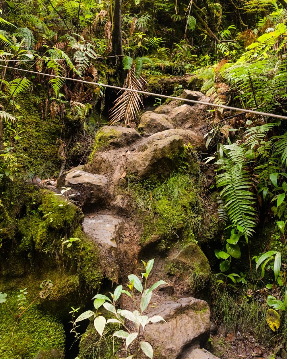
If it weren’t for all the mud this next section of track would be really easy - so hopefully you luck out with conditions! The forest is dense and beautiful, plants are trying to reclaim the narrow path, and the effect is that you feel fully immersed in nature.
At the 1.5km mark you’ll come to your first creek crossing. There are rocks to use as stepping stones here.
Getting wet is inevitable as the track goes on, so whether you choose to rock hop or just slosh right through depends on whether you want to keep your boots dry until the last moment. In the end I just walked straight through the water.
Following the crossing there is a very short uphill section before you arrive at what for us, was the muddiest bit of the whole track.
There wasn’t really a way around it, so if you’re in the same boat, then tie your shoes up tight because this mud will claim them given half the chance.
The second river crossing comes 2.1km into the walk and again we just walked through the water, though you could still rock hop at this point.
The water was a bit deeper here and if you weren’t careful you could go in way over knee height - but again, it had been super wet in this area, so it may normally be lower.
The river crossings continue
After this, you’ll have a bit of open track away from the cover of the forest, and for us it continued to be a mud bath. However by this point we were sort of getting used to it and no longer tried to keep our boots clean - they got a bit of a wash with each river crossing which helped.
There are some undulations as you continue along the trail, but never any bits which are steep. The terrain can be uneven, but despite the mud, there weren’t any ups or downs which were slippery.
You will have spent a bit of time outside the forest with views to distant forested mountains, and at the 3km mark you re-enter the rainforest again. It’s particularly pretty and there’s a bit of a break in the mud.
Just 50m later you’ll make the third river crossing, again rock hopping is still possible. There’s a little bit of uphill through the forest and then you’ll come to another series of river crossings.
I think there were technically three, but they sort of merge together to form one long one.
It was roughly 150m of rock hopping, or wading in water above the knee, but below the hips. Our guide stayed dry this whole time, so you definitely could if you don’t mind navigating a lot of sometimes slippery rocks.
The inevitable wading begins
Following the series of river crossings there’s some uphill on a dirt track. It’s rough and uneven, but not difficult. At the 4km mark the river turns a sensational pale blue and this is when I breathed a sigh of relief.
With so much preceding rain I’d wondered if the falls would have lost their spectacular blue colour, but as soon as I saw the turquoise river, I knew it would be ok! It’s not that the waterfall wouldn’t have been amazing without the blue water, but it definitely adds a touch of magic.
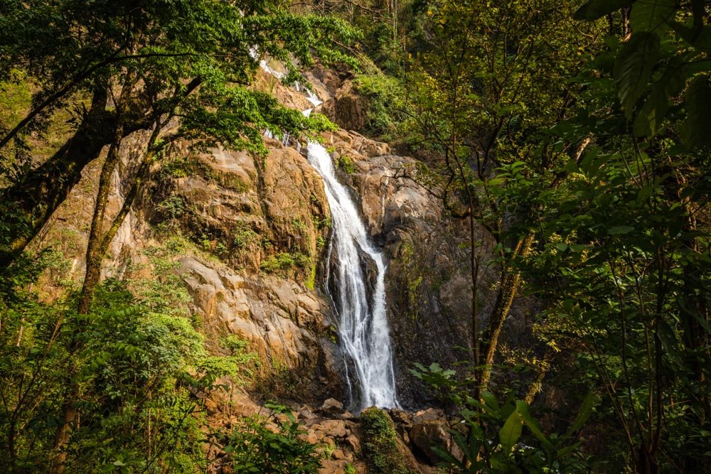
At the 4.5km mark you’ll pass a small waterfall and then see the top of the main falls in the distance and it looks incredible - so wild and beautiful.
The cascades are backed by endless jagged peaks covered in thick rainforest. It’s a real Indiana Jones moment, made even more special by the fact we never saw another soul.
There are more river crossings and it’s around this point that you can’t always rock hop. A lot of the trail now crisscrosses through the water and though you’ll climb some rocks and boulders too, you will have to get wet.
Even with all the mud, we knew it was going to be worth it.
You’ll get another good closer view as you continue along the trail, which is now a mix of walking straight up the river and along the river banks.
For us the water was a mix of very shallow (below the knee) and occasionally waist height (but only for the odd moment). It’s not difficult, but it is a bit tedious as you try to keep your balance.
At the 4.8km mark you have a very short descent on a dirt trail where there is a rope in place to help. It’s only a few steps and nice and stable with the rope.
From here you are just 300m away from the falls. You’ll walk through the river and over a few rocks here and there. We did hit a few deep (waist high) patches here, but our guide didn’t, so if you follow your guide more closely you shouldn’t get overly wet!
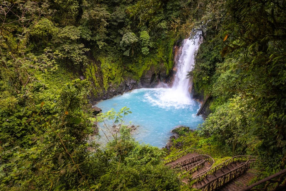
At the 5.1km mark you’ll round a corner and there it is. Catarata Vuelta del Cañon, one of the most beautiful waterfalls in all of Costa Rica.
Catarata Vuelta del Cañon
Catarata Vuelta del Cañon is enchanting, like something from a fairytale, or maybe The Lord of the Rings! It’s a double drop waterfall, surrounded by steep moss covered canyon walls.
The shape of the canyon is also unusual, almost like there’s a bowl that the second falls cascades over.
The fact the water colour is turquoise is the icing on the cake. It’s magical. I’ll never understand how we shared La Fortuna Waterfall with 100 other people at 8am (no joke, I counted) and yet here there was no one, at 11am no less.
I’m not knocking La Fortuna Waterfall, it’s beautiful too, but there’s really no comparison.
Catarata Vuelta del Cañon is the stuff dreams are made of and photos really don’t do it justice.
There are plenty of rocks around the falls where you can sit and relax, and this is a good place to have lunch if you brought something with you.
Swimming at Catarata Vuelta del Cañon
The pool is very easy to access. There’s not much in the way of rocks to climb over, and the water is shallow before deepening as you get closer to the falls.
The pool isn’t massive, but it’s big enough to swim a few lengths and you can jump off the left side too (although I didn’t).
The one thing that won’t be for everyone is the temperature. As you’re high up in a cloud forest, it’s pretty cold. Not glacial like my cloud forest swim in San Gerardo de Dota but pretty damn cold nonetheless.
It’s totally worth it though and the cold water will definitely make you feel alive! The walk is also long enough on the way back that you warm up again. If you’re here on a sunny day you might warm up on the rocks, but the weather was pretty grim on our visit.
Heading back
The way back follows the same route, but we did find it was a little quicker thankfully. I guess we had our mud legs and weren’t so tentative. It took us less than two hours to get back and then it was time for a well earned coffee!
Getting to Catarata Vuelta del Cañon
Catarata Vuelta del Cañon is located in Bajos del Toro, the car park is marked on Google maps here. However as mentioned you can’t usually just rock up as there is rarely anyone manning the ‘desk’ here.
The drive is roughly 66km and 2 hours from San Jose. There are some very steep and windy mountain roads, with no safety barriers, so drive slowly - you pretty much have to anyway due to the gradient! There are many potholes along the way.
It’s a little further from La Fortuna, but a slightly quicker drive, the roads are not steep and there are less potholes (but still plenty as you arrive at or leave Bajos).
Both these roads are paved and you do not need a 4WD, we did it once in an old 4WD and once in a small Yaris and it was actually slightly easier in the newer Yaris!
It’s an area where it’s much easier to have a rental car as public transport is limited.
Facilities at Catarata Vuelta del Cañon
At the car park there is a toilet, but otherwise there are no facilities anywhere along the track. You’ll need to carry all rubbish out with you. As with all the trails in Bajos del Toro, it was pristine here, which was so good to see.
This post may contain affiliate links, meaning at no additional cost to you, we will earn a small commission if you click through and decide to make a purchase. This helps towards the costs of running our website. Thanks for your support.


