

Bomaderry Creek is a beautiful gorge, which though just outside Nowra town centre, feels a world away. You’ll walk beneath endless giant cliffs and alongside the picturesque creek, with plenty of interesting overhangs and rock formations to explore. The trail remains quite shady even on the sunniest of days, though we think the best conditions for this walk are a damp cloudy day when the forest feels much more atmospheric.
The walk is quite easy, though the terrain is often uneven and there a few little climbs.
Here’s everything you need to know about the Bomaderry Creek walk.

The Bomaderry Creek Walk (aka She-Oak Crossing Walk)
The stats
Distance: 4.3km circuit
Elevation gain: 120m
Difficulty: Easy - moderate
Summary: The Bomaderry Creek Walk (She-Oak Crossing Walk) is all on a maintained track, but does have some rougher sections, which includes climbing over rocks. There are a few short climbs, but they’re never long or overly steep.
There is one ladder, though there is no exposure when on the ladder. To complete the circuit you’ll need to make one creek crossing which is done using rocks for stepping stones, this is not difficult in normal times, but could be impassable after very heavy rain.
Dogs are welcome on this track provided they are kept on a lead.

Starting the trail: along the top of the gorge
From the parking area (details below) the walk heads around the gate and down the road, passing the picnic area and toilet block. After 110m you’ll reach a junction and head right, the first lookout of the trail is just 30m away. It overlooks the weir, it’s nice enough, but not as good as the views further on, which feel more wild.
From the lookout the trail continues left and reaches a second viewpoint 240m later. It’s a large rock platform overlooking the gorge, which is quite obscured by trees, but a pretty view nonetheless.
You have a further 120m on top of the gorge before beginning the descent, which is mainly on stone steps and there’s a handrail in place.

Along the cliff walls
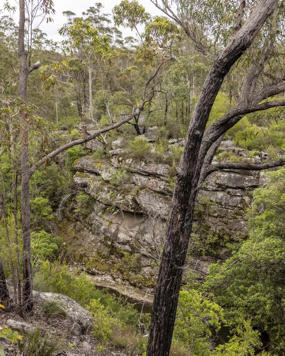
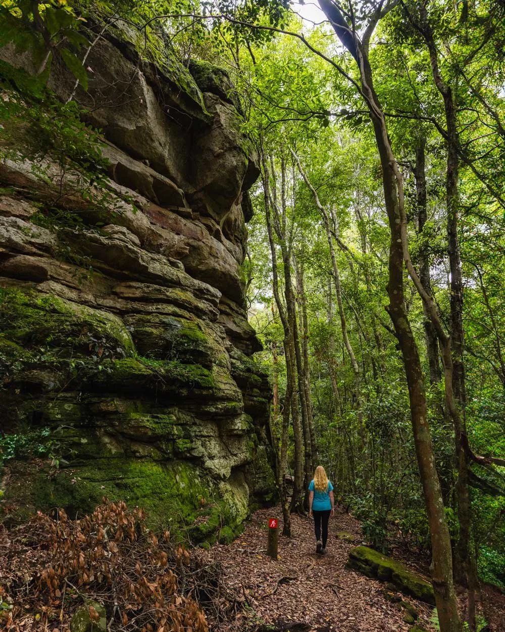
After a 50m descent you’ll reach Mossy Gully, and follow the track left, it’s signposted as She-Oak Crossing. From here the trail gets much more interesting as you’re walking alongside the creek with towering cliff walls to your left. The walls get higher the further you walk and it starts to feel quite dramatic.


You’ll reach a pretty overhang with a bench seat 150m after turning into Mossy Gully, the first of many along the trail. This one is quite modest in comparison to some of the ones further along the track.

There are a few uneven rocky sections, but the path is easy to follow and regularly signposted. There are lots of boulders and interesting formations to check out along the way.
A couple of hundred metres beyond the bench seat you’ll reach Bernie’s Bend and the cliffs get even more imposing. Following this there’s a short section where you leave the cliffs and enter forest, but it’s not long before you’re back alongside the big walls again.
The overhangs continue
Just over 1.3km into the walk there are some uneven stone steps leading uphill between the rock walls. To the right of this (at the bottom of the stairs) you can make a short detour. Head right, down a couple of rocks and along the cliff walls.

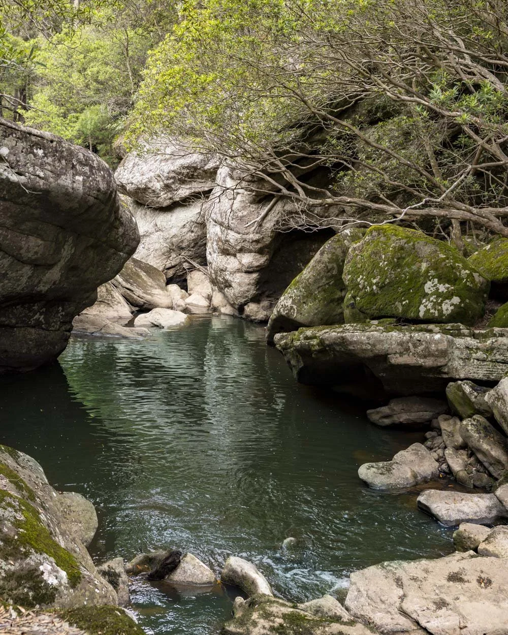
There’s a fun little boulder jam in one of the walls and you can also get down to a very pretty part of the creek. There were lots of water dragons here who were remarkably unperturbed by our presence. The cascades and rock formations around this part of the creek create two distinct pools, both of which are very scenic.

It had been too wet to consider swimming when we visited, but it looks like it would normally be a wonderful secluded spot. I wasn’t sure about urban run off as it is so close to Nowra, but after a quick Google it seems people do swim in Bomaderry Creek, though I wouldn’t advise it after rain just incase.
You can then retrace your steps and head up the stairway, which leads to yet more dramatic overhangs and possibly the best bench seat of the walk!


From here the track continues under many overhangs and it’s sometimes rocky, but it isn’t slippery when dry. Just over 1.8km into the walk, you’ll reach a series of stone steps leading downhill which are signposted simply as ‘The Steps’.
They’ll lead downhill to the creek, where’s there is a signpost and you need to head right towards River Oak Crossing. This creek crossing is on a small metal bridge and the path continues on the other side of the water and heads briefly uphill into the bush.

You’ll follow the trail just above the cascades and there are some nice spots where it is easy to cut down to the water if you fancy a paddle.
To She-Oak Crossing and completing the circuit
At roughly the 2.3km mark you’ll come to a small ladder. It’s metal and sturdy enough, without any exposure. There’s a small ladder (around half the size) on the other side of the rock to get onto the next part of the trail. The path then continues into Fern Glen, which is pretty, though there are plenty of ferny areas throughout the track!

Approximately 100m beyond the glen there’s a little bit of track which has suffered from debris and the signpost has been partially taken out too. It’s easiest to head right at the small stump, as the more obvious looking trail just before it involves crossing quite a large patch of debris.
The trail then continues through the bush and alongside more cliffs for 850m before you make a left turn up a staircase. The path flattens 100m later and you’ll keep heading straight on at the next junction. This leads to another gorge lookout 20m later. It’s similar to the second lookout of the track. There’s a further lookout 180m later, before you head back downhill into the bush once again.


The final creek crossing, She-Oak Crossing, is 300m away and this is the one where you need to use the rocks as stepping stones. Watch out for any wet ones which can be slippery. There are a couple of different possibilities for crossing here, providing that water levels are not so high as to have submerged the rocks.

After crossing the creek you’ll head up onto the rock platforms and left onto the dirt path. A short staircase leading uphill will take you to a junction around 100m later, where you make a left turn back onto the original trail you started on.
Getting to the Bomaderry Creek Walk
The closest parking place to the trailhead is at the lay-bys to the left and right of the gate, which you can find here on Google maps. If these are full there’s a large car park just over the road which didn’t have a single car in it in the school Christmas holidays, so you shouldn’t have any trouble parking.
The car park is located 5km (10 mins) from the centre of Nowra and 28km (30 mins) from Huskisson in Jervis Bay.
There are toilet and picnic facilities a few minutes into the walk, but nowhere else along the trail. Please remember to carry out all rubbish with you.
This post may contain affiliate links, meaning at no additional cost to you, that we will earn a small commission if you click through and decide to make a purchase. This helps towards the costs of running our website. Thanks for your support.


